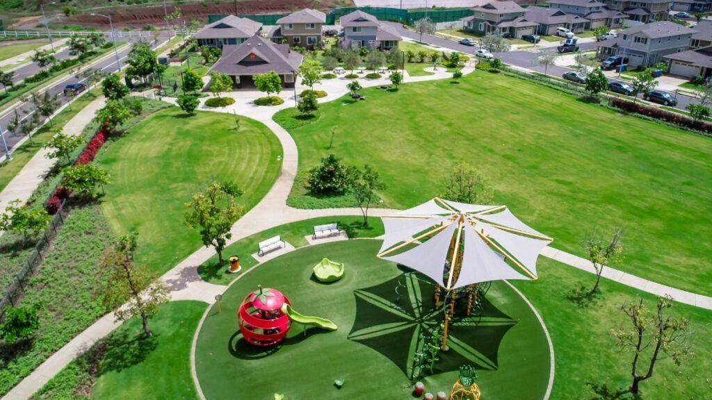
ʻAhakea update — September 29, 2026: Detached GenHomes are the first phase; the second phase adds townhomes and attached FLEX homes. Older detached prices below are historical, not current offers. Confirm pricing and availability by home type. Compare the two phases.
Ho‘opili pricing note, October 30, 2026: Prices and available homes change weekly, so this map shows status only. For current prices, see the Hoʻopili overview and the dated Ho‘opili pricing guide.
Hoʻopili spans roughly 1,500 acres between Ewa Beach and Kapolei on Oʻahu’s west side, with about 11,750 planned homes across 18+ neighborhoods built over a 20-year master plan by D.R. Horton. As of October 30, 2026, D.R. Horton lists Kāpili, Uluwehi, ʻAhakea and Nanahea as Now Selling and labels Alana Sold Out, while more than a dozen earlier neighborhoods are complete and sold out and several future phases remain on the drawing board. This hoʻopili map guide breaks down every neighborhood by location, status, and home type so you can orient yourself before visiting or buying.
Hoʻopili Quick Facts
- Developer: D.R. Horton Hawaiʻi
- Location: Between Ewa Beach & Kapolei, West Oʻahu
- Total Planned Homes: ~11,750
- Acreage: ~1,500 acres
- Prices: Change weekly; see current Hoʻopili prices
- Home Types: Condos, townhomes, single-family, FLEX homes, multigenerational
- Planned Schools: 5 (3 elementary, 1 middle, 1 high school)
- Parks: 9 planned (multiple completed)
- Rail Stations: 2 (UH West Oʻahu, Hoʻopili)
- Build-Out Timeline: ~2016–2035
Hoʻopili Map: Understanding the Layout
Hoʻopili stretches from Fort Weaver Road on the east to Kualakai Parkway on the west, sitting just north of Ka Makana Aliʻi mall and south of Farrington Highway. The community is organized into distinct phases that have rolled out roughly from east to west over the past decade.
The earliest neighborhoods—Akoko, Haʻakea, and Hāloa—sit in the eastern portion closest to Ewa Beach. Middle phases like Hoʻoulu, Iliahi, Kanalani, and Ikena fill the central corridor near Konane Park and the Soho Community Center. The newer neighborhoods include the Pōhaku Estates section (Alana and Kāpili) on the western edge closer to Kapolei and the future East Kapolei High School site, plus Uluwehi, ʻAhakea, and Nanahea on the Ewa Beach side.
Two Honolulu Rail Transit (Skyline) stations bookend the development: the Keoneʻae (UH West Oʻahu) Station on the western edge, next to the university, and the Honouliuli (Hoʻopili) Station to the northeast, toward Farrington Highway. Both stations have been open since June 2023, and Skyline’s Segment 2 (October 2025) extended service through Pearl Harbor and the airport to Middle Street—so residents can already ride toward town without a car. HART targets March 2031 for service to the Civic Center station downtown. The Kakaʻako and Ala Moana stations will be built in a later phase.
Hoʻopili Neighborhoods by Phase & Status
Below is a comprehensive reference of every known Hoʻopili neighborhood, organized by development phase. Use this table to quickly compare home types, approximate pricing, and current status. For deeper dives, click through to individual neighborhood pages where available.
Completed & Sold-Out Neighborhoods (Phases 1–10)
| Neighborhood | Home Type | Beds | Approx. Price Range | Status |
|---|---|---|---|---|
| Akoko | Townhomes & Condos (Affordable + Market) | 1–3 | $300K–$550K (original) | Sold Out |
| Haʻakea | Single-Family Homes | 3–4 | $600K–$900K (original) | Sold Out |
| Hāloa | Townhomes, Condos, Duplexes, FLEX Homes | 1–4 | $400K–$700K (original) | Sold Out |
| Iliahi | Single-Family, Duplexes, ADU Options | 3–4 | $700K–$1M (original) | Sold Out |
| Kohina | Condos, Townhomes, FLEX Homes (Affordable + Market) | Studio–4 | $300K–$650K (original) | Sold Out |
| Hoʻoulu | Modern Plantation Single-Family | 2–3 | $500K–$700K (original) | Sold Out |
| Ilima | Split-Level Townhomes | 2–3 | $500K–$700K (original) | Sold Out |
| Kanalani | Traditional Single-Family | 3–4 | $750K–$1M (original) | Sold Out |
| Ikena / Bluffs at Ikena | Contemporary Single-Family | 3–4 | $800K–$1.2M (original) | Sold Out |
| Hinahina | Single-Family Condos | 3 | $800K–$1M (original) | Sold Out |
| Lehua | Single-Family Homes | 3–4 | $800K–$1.1M (original) | Sold Out |
| Mamaka | Small-Lot Single-Family Condos | 3–4 | $700K–$950K (original) | Sold Out |
| Nanaiʻna / Bluffs at Nanaiʻna | Large Single-Family (up to 2,372 sq ft) | 4 | $1M–$1.45M (original) | Sold Out |
| Mōlehu | Small-Lot Single-Family Condos | 3–4 | $867K–$887K (original) | Sold Out |
| Noho Papa | Townhomes, FLEX Homes, Split-Level | 3–4 | $1.02M–$1.15M (original) | Sold Out |
| Nahele | Condos | 1–3 | $400K–$600K (original) | Sold Out |
Current and Recent Releases
| Neighborhood | Home Type | Beds | Pricing | Status |
|---|---|---|---|---|
| Alana | Condo Homes | 2–3 | — | Sold Out (D.R. Horton, checked October 30, 2026) |
| Kāpili | Multifamily Condos | 1–3 | See current Kāpili prices | Now Selling (checked October 30, 2026) |
| Uluwehi | Condos (572–1,056 sq ft) | 1–3 | See current Uluwehi prices | Now Selling (checked October 30, 2026) |
| ʻAhakea | Detached Condos / GenHomes (880–997 sq ft) | 3 | See current ʻAhakea prices | Now Selling (checked October 30, 2026) |
| Nanahea | Single-Family Homes (1,092–1,859 sq ft) | 3–5 | See Nanahea pricing and availability | Now Selling (checked October 30, 2026) |
Statuses checked on drhorton.com October 30, 2026. Prices change weekly; see each neighborhood page. Alana and Kāpili are part of the Pōhaku Estates section on the Kapolei side; Uluwehi, ʻAhakea, and Nanahea sit on the Ewa Beach side of the development.
Future Planned Phases
D.R. Horton has not publicly announced all remaining phase names, but the Hoʻopili master plan calls for continued development through approximately 2035. Expect additional single-family, townhome, and mixed-use neighborhoods to be released over the coming years, expanding further west toward Kualakai Parkway. Future phases will likely include more affordable housing lottery opportunities as well as market-rate offerings.
Based on the development pattern so far, D.R. Horton typically releases new neighborhoods in small batches every 12–18 months, often grouping them into themed “collections” like the current Pōhaku Estates phase. To stay informed about upcoming releases, monitor the official Hoʻopili website or sign up for their interest list—new phase announcements usually come with 3–6 months’ notice before sales launch. Affordable housing lottery phases are announced separately through the Hawaiʻi Housing Finance and Development Corporation (HHFDC), typically requiring advance registration and income verification before the lottery draw.
Key Landmarks on the Hoʻopili Map
Beyond the residential neighborhoods, Hoʻopili’s master plan includes infrastructure that sets it apart from other Oʻahu developments. Schools, parks, rail stations, and commercial zones are woven into the community rather than tacked on as afterthoughts. Here’s what buyers should know about each category.
Rail Transit Stations
Two Skyline rail stations serve Hoʻopili, providing car-free access to Honolulu:
- Keoneʻae (UH West Oʻahu) Station — western edge of the development, adjacent to the university campus
- Honouliuli (Hoʻopili) Station — north-central area toward Farrington Highway, planned as a “downtown” transit hub with mixed-use development around it
Schools (5 Planned)
- 3 Elementary Schools — the first, East Kapolei Elementary, broke ground October 14, 2026 and is expected to open for the 2029–30 school year
- 1 Middle School — planned for the central area
- 1 High School — a future East Kapolei high school is planned; no construction start has been announced
Parks & Recreation (9 Planned)
- Konane Park — the community’s main park with soccer fields, playground, and open green space (completed)
- Soho Park & Community Center — recreation center with pool, gathering spaces (completed)
- Bark and Ride Dog Park — off-leash dog area near the rail station (completed)
- The Pearl — exercise park near The Bluffs at Ikena (completed)
- Basketball, Volleyball & Pickleball Courts — near the Hoʻoulu neighborhood (completed)
- Community Garden — located near the Kaikea neighborhood (completed)
- Additional Recreation Centers — 7 total rec centers with pools planned at build-out
Commercial & Retail
- Ka Makana Aliʻi Mall — major shopping center just south of Hoʻopili with restaurants, movie theater, retail
- FLEX Home Commercial Zones — ground-floor business spaces in mixed-use neighborhoods like Kohina and Noho Papa
- Planned Retail & Office Space — about 3 million sq ft of commercial space in the master plan
Hoʻopili Walking & Biking Trail Network
One of Hoʻopili’s standout features is its emphasis on walkability and connectivity. The master plan includes a network of multi-use paths and sidewalks linking neighborhoods to parks, schools, and transit stations. Key trail features include:
- Neighborhood connector paths — dedicated walking and biking paths run between most completed neighborhoods, making it easy to reach parks and the community center without driving
- Rail station access trails — pedestrian paths connect residential areas directly to both Skyline stations
- Park loop trails — paths circling Konane Park and other green spaces offer recreational walking routes
- Future expansion — as new phases build out, the trail network will extend westward, eventually connecting all neighborhoods in a continuous loop
- ADA accessibility — paths are designed to ADA standards with gentle grades, making them accessible for strollers, wheelchairs, and electric scooters
For residents who prefer not to drive, the combination of rail transit, walking paths, and close proximity to Ka Makana Aliʻi creates a rare “live, work, play” environment for West Oʻahu.
Geographic Context: How Hoʻopili Connects to West Oʻahu
Hoʻopili sits at the geographic heart of Oʻahu’s fastest-growing corridor. Here’s how it connects to key destinations:
- Kapolei Town Center: ~5 minutes west via Kualakai Parkway
- Ka Makana Aliʻi Mall: Adjacent, walkable from southern neighborhoods
- White Plains Beach: ~10 minutes south
- Joint Base Pearl Harbor–Hickam: ~20 minutes east via H-1
- Schofield Barracks: ~25 minutes north via H-2
- Downtown Honolulu: ~30–40 minutes via H-1 (or Skyline rail toward town)
- Daniel K. Inouye International Airport: ~25 minutes east via H-1
Military families stationed at Pearl Harbor, Schofield Barracks, or Camp H.M. Smith find Hoʻopili attractive for its relative affordability and proximity to multiple bases. Skyline service from the two Hoʻopili stations reduces commute dependency on the often-congested H-1 freeway.
Most Hoʻopili residents access the H-1 freeway via Exit 3 (Kualakaʻi Parkway) or Exit 5 (Fort Weaver Road). Peak-hour commutes to town can stretch 45–60 minutes during rush hour (6:30–8:30 AM eastbound, 3:30–6:00 PM westbound), but off-peak drives to Pearl Harbor or the airport typically stay under 25 minutes. The westbound commute against traffic is almost always smooth for those working in Kapolei or at military installations west of Pearl Harbor.
Frequently Asked Questions
Where is Hoʻopili located on Oʻahu?
Hoʻopili is located between Ewa Beach and Kapolei on Oʻahu’s west side, stretching from Fort Weaver Road to Kualakai Parkway. The area is sometimes referred to as East Kapolei and sits just north of Ka Makana Aliʻi mall.
How many neighborhoods are in Hoʻopili?
Hoʻopili has 18+ neighborhoods across its master plan. As of October 30, 2026, D.R. Horton lists four neighborhoods as Now Selling (Kāpili, Uluwehi, ʻAhakea and Nanahea). Alana and about 16 earlier neighborhoods are sold out. Additional phases will be released through approximately 2035.
Which Hoʻopili neighborhoods are currently selling in 2026?
As of October 30, 2026, D.R. Horton lists four Hoʻopili neighborhoods as Now Selling: Uluwehi (condos), Kāpili (multifamily condos), ʻAhakea (detached GenHomes) and Nanahea (single-family condominium homes). Alana, which with Kāpili makes up the Pōhaku Estates section, is labeled Sold Out. Prices change weekly; see current Hoʻopili prices.
What is the Hoʻopili master plan?
The Hoʻopili master plan is a 20-year development by D.R. Horton covering approximately 1,500 acres. It includes roughly 11,750 homes, sites for 5 schools, parks and recreation centers, about 3 million sq ft of commercial space, and two rail transit stations. Development began around 2016 and is expected to reach completion by approximately 2035.
Does Hoʻopili have rail access?
Yes. Hoʻopili is served by two Skyline rail stations: the Keoneʻae (UH West Oʻahu) Station on the western edge and the Honouliuli (Hoʻopili) Station to the northeast. Both stations opened in June 2023, and Skyline now runs through Pearl Harbor and the airport to Middle Street. HART targets March 2031 for service to the Civic Center station downtown.
What are the most affordable neighborhoods at Hoʻopili?
Among the neighborhoods selling now, Uluwehi condos have the lowest advertised entry prices (checked October 30, 2026). Prices change weekly; see current Hoʻopili prices. Earlier phases like Akoko and Kohina offered affordable housing lottery units at lower price points, but those neighborhoods are now sold out. Check the affordable housing hub for current lottery opportunities.
Are there walking and biking paths at Hoʻopili?
Yes. Hoʻopili features a network of multi-use walking and biking paths connecting neighborhoods to parks, schools, and the two rail stations. The trail network continues to expand as new phases are built, with the goal of creating a fully connected, walkable community.
How close is Hoʻopili to military bases?
Hoʻopili is approximately 20 minutes from Joint Base Pearl Harbor–Hickam and about 25 minutes from Schofield Barracks via H-1 and H-2. It’s one of the most popular new construction communities for military families using their Honolulu BAH toward a home purchase.
Your next step
Weighing Hoʻopili?
Team Wong can walk you through current releases, the neighborhoods and resale options, and what each one costs to own.
Ask Team Wong